Digby, Nova Scotia - As it turned out, the best thing about New Brunswick was getting there. Which is why I'm not there anymore.
My first night off of the Adventure Cycling maps brought me to Lubec, Maine, the Easternmost town in the USA. It's a picturesque little village on a hill amid a series of tidal flats. It's also home to some very exorbitant campsites, which is why when I rolled into town on Thursday night I decided to look for alternatives.
Handily enough, I wandered into a $6 all-you-can-eat barbeque in the middle of town put on by the local Masons. I helped myself to a ridiculous amount of food, then asked the head Mason honcho is he minded terribly if I threw my tent up on their lawn. He didn't, so I camped for free in the middle of downtown Lubec.
Making my visit even more memorable, I was heading out of town the next morning when a writer for the local paper saw me and decided she wanted to do a story on my trip. So sometime in the next month my photo and a (brief, I imagine) piece about me will be appearing in the Quoddy Times, a bi-monthly regional paper. Look for it at your local newsstand, unless you don't live within a 10-mile radius of Lubec, Maine. In that case, just read USA Today. It's got pretty colors and stuff.
After Lubec I passed over a small bridge onto Campobello Island, which is actually in New Brunswick. Its also the home of FDR's rather impressive summer home, which I took a tour of before catching a tiny car ferry to Deer Island, about half an hour away. I then rode the length of Deer Island (about 10 mostly forested and uninhabited miles) to get to another ferry, which dropped me on the New Brunswick mainland. This may all seem rather complicated, but it cuts about 100 miles of riding off the trip, so I figured it was worth the trouble. Plus I'm just a sucker for a ferry ride.
From there on out, unfortunately, New Brunswick started to go downhill. Traffic was bad and I had no choice but to ride a long stretch of Highway 1, which is effectively an interstate. No fun at all. Then, as luck would have it, I blew another spoke, this one behind the cassette on my rear wheel (meaning I would need a bike shop to fix it.) And it started to rain.
So I threw up my arms (or, rather, my thumb) and caught a ride the last 20 miles into the harbor city of St. John with a couple of roughneck pipeline inspectors. They dropped me at a bike shop and I was able to get on my way in about 30 minutes.
But it was then that I started to wonder where "on my way" would actually take me. My intent was to bike through the length of New Brunswick so I could turn off into Nova Scotia. But New Brunswick had been severely disappointing me all day: no scenery at all, no shoulders, and I looked at the map and saw nothing but a two-day trudge to get through it to my ultimate destination.
So, about 10 miles past St. John - and this is the great part about not using the maps - I decided, "forget it." I turned the bike around, found a campsite near the city center, and first thing this morning I hopped the "Princess of Acadia" for the three-hour ferry ride from St. John to Digby, Nova Scotia. That's where I am now, ready to (hopefully) enjoy some greatly improved riding conditions for the next few days as I work my way east to Halifax.
New Brunswick was a bust, but I'm glad I went: It was worth it to see the northern Maine coast, Lubec and the islands.
Good thing #1 about Nova Scotia: really fast computers, allowing me to post pictures with ease. So here are a few:
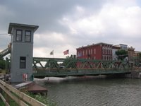
Brockport, NY: I loved riding the western stretch of the canal, primarily because it passed an endless succession of quaint towns, each one reachable by a freshly painted drawbridge over the canal.

Palmyra, NY: Here's an interesting bit of US history I almost blew past. Just south of Palmyra is the Smith farm, where 14-year-old Joseph Smith had the first of the visions that led him to found the Mormon church. Here's the farmhouse he lived in; those trees in the rear are the edge of the "Sacred Grove," where Smith actually saw whatever it is he saw.
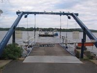
Ticonderoga, NY - The first of what are turning out to be numerous quaint l'il ferry rides on this trip took me across Lake Champlain from Ticonderoga into Vermont. This one's actually a chain ferry.

Bar Harbor, Maine - The town pier, end of the road for the Northern Tier route.
 Outside Lubec, Maine - End of the road for the continental United States.
My first night off of the Adventure Cycling maps brought me to Lubec, Maine, the Easternmost town in the USA. It's a picturesque little village on a hill amid a series of tidal flats. It's also home to some very exorbitant campsites, which is why when I rolled into town on Thursday night I decided to look for alternatives.
Handily enough, I wandered into a $6 all-you-can-eat barbeque in the middle of town put on by the local Masons. I helped myself to a ridiculous amount of food, then asked the head Mason honcho is he minded terribly if I threw my tent up on their lawn. He didn't, so I camped for free in the middle of downtown Lubec.
Making my visit even more memorable, I was heading out of town the next morning when a writer for the local paper saw me and decided she wanted to do a story on my trip. So sometime in the next month my photo and a (brief, I imagine) piece about me will be appearing in the Quoddy Times, a bi-monthly regional paper. Look for it at your local newsstand, unless you don't live within a 10-mile radius of Lubec, Maine. In that case, just read USA Today. It's got pretty colors and stuff.
After Lubec I passed over a small bridge onto Campobello Island, which is actually in New Brunswick. Its also the home of FDR's rather impressive summer home, which I took a tour of before catching a tiny car ferry to Deer Island, about half an hour away. I then rode the length of Deer Island (about 10 mostly forested and uninhabited miles) to get to another ferry, which dropped me on the New Brunswick mainland. This may all seem rather complicated, but it cuts about 100 miles of riding off the trip, so I figured it was worth the trouble. Plus I'm just a sucker for a ferry ride.
From there on out, unfortunately, New Brunswick started to go downhill. Traffic was bad and I had no choice but to ride a long stretch of Highway 1, which is effectively an interstate. No fun at all. Then, as luck would have it, I blew another spoke, this one behind the cassette on my rear wheel (meaning I would need a bike shop to fix it.) And it started to rain.
So I threw up my arms (or, rather, my thumb) and caught a ride the last 20 miles into the harbor city of St. John with a couple of roughneck pipeline inspectors. They dropped me at a bike shop and I was able to get on my way in about 30 minutes.
But it was then that I started to wonder where "on my way" would actually take me. My intent was to bike through the length of New Brunswick so I could turn off into Nova Scotia. But New Brunswick had been severely disappointing me all day: no scenery at all, no shoulders, and I looked at the map and saw nothing but a two-day trudge to get through it to my ultimate destination.
So, about 10 miles past St. John - and this is the great part about not using the maps - I decided, "forget it." I turned the bike around, found a campsite near the city center, and first thing this morning I hopped the "Princess of Acadia" for the three-hour ferry ride from St. John to Digby, Nova Scotia. That's where I am now, ready to (hopefully) enjoy some greatly improved riding conditions for the next few days as I work my way east to Halifax.
New Brunswick was a bust, but I'm glad I went: It was worth it to see the northern Maine coast, Lubec and the islands.
Good thing #1 about Nova Scotia: really fast computers, allowing me to post pictures with ease. So here are a few:

Brockport, NY: I loved riding the western stretch of the canal, primarily because it passed an endless succession of quaint towns, each one reachable by a freshly painted drawbridge over the canal.
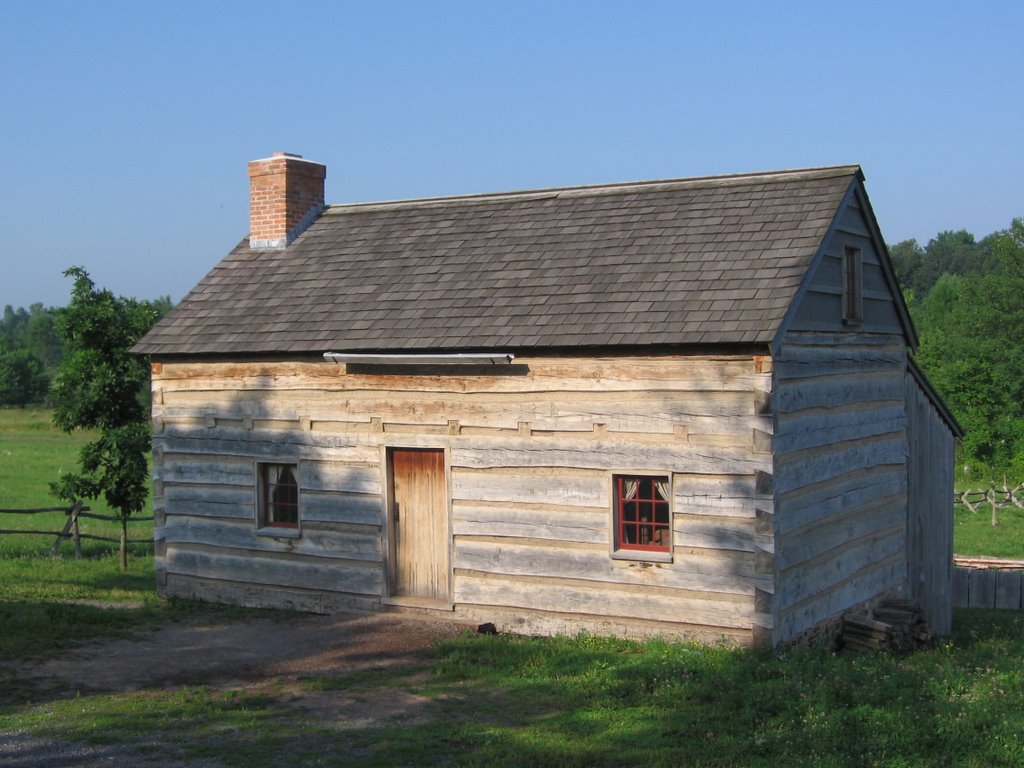
Palmyra, NY: Here's an interesting bit of US history I almost blew past. Just south of Palmyra is the Smith farm, where 14-year-old Joseph Smith had the first of the visions that led him to found the Mormon church. Here's the farmhouse he lived in; those trees in the rear are the edge of the "Sacred Grove," where Smith actually saw whatever it is he saw.

Ticonderoga, NY - The first of what are turning out to be numerous quaint l'il ferry rides on this trip took me across Lake Champlain from Ticonderoga into Vermont. This one's actually a chain ferry.
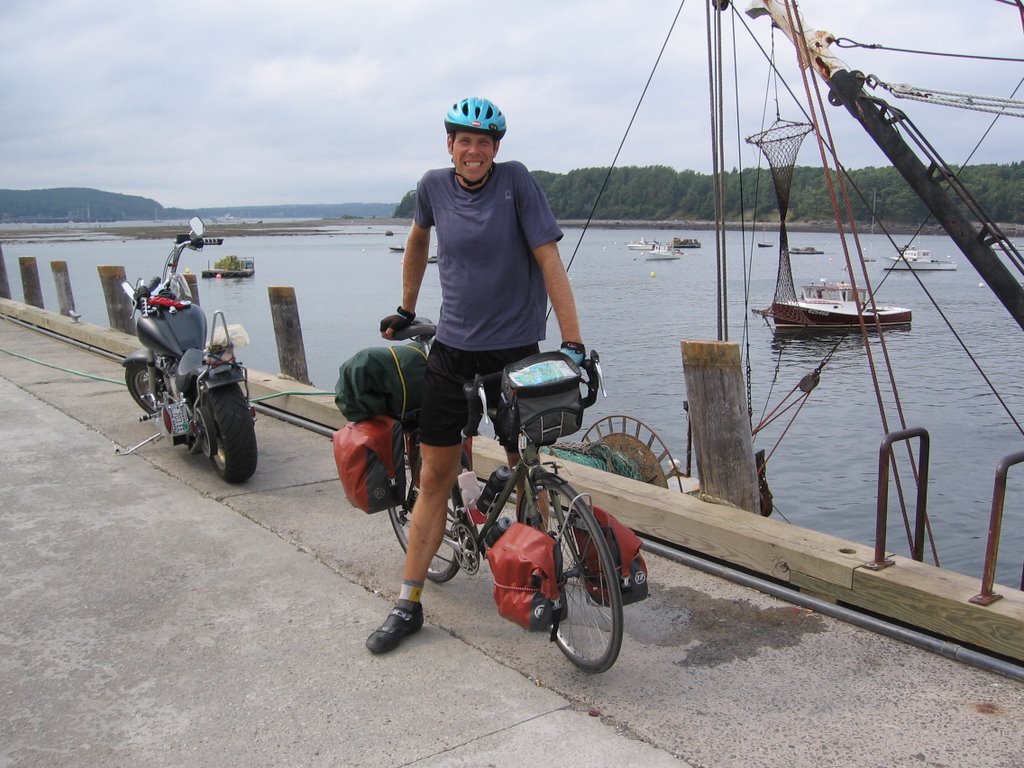
Bar Harbor, Maine - The town pier, end of the road for the Northern Tier route.
 Outside Lubec, Maine - End of the road for the continental United States.
3 Responses to “Northward Ho!”
Leave a Reply
About me
I'm Tom Moran, a bicyclist from Fairbanks, Alaska. I'm spending the summer of 2006 riding from Anacortes, Wash., to Bar Harbor, Maine.
Hi Tom;
Been following your progress..... Just yesterday I was wondering why some big newspapers or national TV hasn't picked up on your trip. Forget regional newspapers...go for the gusto! Would you mind if I emailed ABC, NBC, or one of them your blog/website? I think you have done a fantastic job and deserve some kudos! let me via your blog.
Marge,
Go ahead, but don't think anyone would be interested. You'd be surprised how many people actually make this trip - I've met dozens. What I'm doing is uncommon, but not that newsworthy, really. I was surprised the paper in Maine was interested, to be honest.
Best regards from NY! proactiv solution Acyclovir 200mg.spravochnik stolic.com Cheap and butalbital and cod Reverse cell phone number cellphone plan compariso alternitive cancer treatments